
A Bartlett Previous Residents Era Guide
The backward trail has no single cutoff. The present parcel view supplies an address, parcel identifier, subdivision, lot and plat clues, while Shelby County archival collections carry the older land and household layer. Treat a result as a clue with a date, not as a complete answer about who lived here before. This guide puts the sources in sequence so a Bartlett address can be compared across the period each source actually documents.
| Evidence source | Documented period | Bartlett-area access point | Address clue supplied |
|---|---|---|---|
| Parcel and GIS viewer | Current interface; map warning references the April 2019 certified roll | Shelby Register property viewer | Parcel, map, owner field, subdivision and plat details |
| Recorded-document index | No single online starting year published | Shelby Register record search | Parties, instruments, recording references and deed chain |
| Direct and reverse deed-index microfilm | 1821-1933 | Tennessee State Library and Archives inventory | Earlier index route for a specified book or year |
| Occupant, Entry and Survey Books | 1819-1962 | Shelby Register Archives | Early tract, survey and first-ownership context |
| Memphis City Directories | 1849-1943 | Register archive and Memphis Public Libraries | Listed household or business through the street section |
| Historic aerials | 1938-current | Shelby Register Archives | Lot and building change, not occupant identity |
Use the current parcel card first when the street address resolves. When it does not, keep the lot, subdivision, plat book and page, tax map, and legal description nearby. Those durable land clues can survive a changed street label more reliably than a modern number.
Begin a Bartlett Previous Residents Trail With Parcel Clues
The Shelby Register property search accepts a street number and street name, owner name, parcel ID, or tax map ID. A selected card can show owner name, property address, owner address, appraisal, tax map, year built, lot number, subdivision, plat book and page, dimensions and acres. Record the field labels exactly. The property address is the parcel situs, while the owner address is only a mailing field and can point to a post-office box, representative, business, or a different location.
The interface links toward appraisal, taxes, recent records and historic aerials, but its combined map, parcel and transaction display carries an April 2019 certified-roll warning. Use it to collect the parcel identifiers, then verify a current transfer in the recorded documents. That division keeps prior-resident research from confusing a map display with legal title.
Key terms. A grantor transfers an interest; a grantee receives it. A chain of title is the documented series of transfers. A legal description identifies land by parcel, lot, plat, subdivision or tract rather than relying only on the mailing-style street address.
Trace Previous Residents With a Shelby Deed Chain
For Bartlett previous residents research, ownership is one layer of the record. The Shelby Register official-record search offers address, party name, document number, book and page, parcel and lot, instrument type, and date-range routes. Its address instruction is deliberately spare: omit direction and street type, such as searching MAIN rather than N MAIN ST. City, ZIP, or subdivision data may be absent from an instrument, so an empty address result does not end the search.
- Search the current address or click the parcel, then save the parcel ID, tax map, lot, subdivision, plat book and page, and legal description.
- Use the address mode and a narrow date range to locate the confirmed purchase instrument for the recorded owner.
- Read that instrument for the seller, document number, book and page, and the land description that ties the record to the parcel.
- Search that seller as a prior grantee to find the earlier acquisition, then repeat one documented transfer at a time.
- When the address route fails, try parcel ID without spaces or dashes, lot and subdivision, party name, instrument number, or book and page. Ask the Register about a specific older book or year rather than assuming an online cutoff.
A warranty deed, quitclaim deed, substitute trustee's deed, mortgage, or comparable-sale entry has its own role. Comparable sales are not a complete chain, and the Register does not conduct title searches for the requester. Read the actual recorded instrument before placing a transfer into the history.
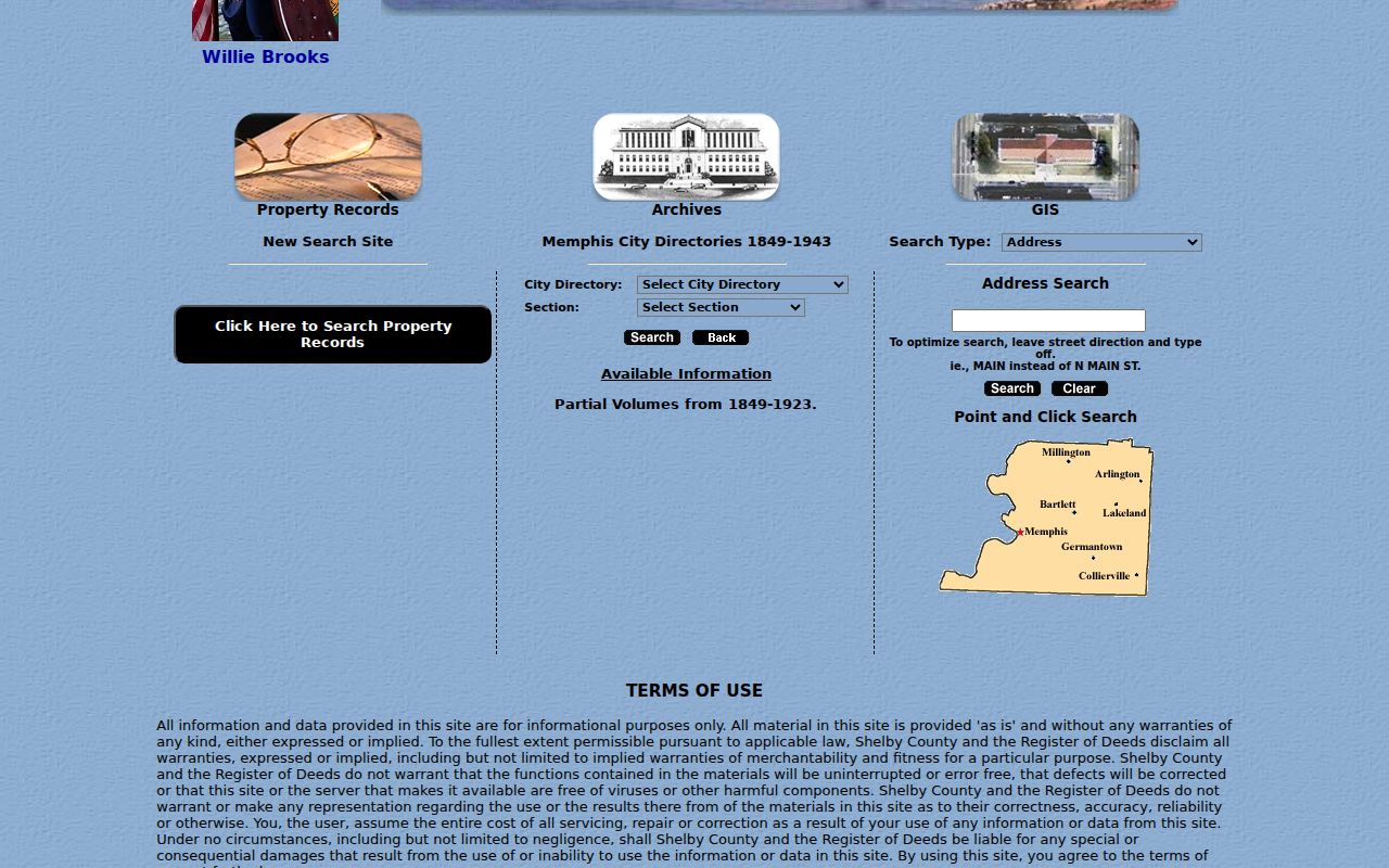
The Register archive search illustrates the separate name, address, parcel, instrument, book/page and directory paths that make this handoff possible.
Bartlett Previous Residents Before Street Addresses
Older Bartlett land research frequently leads to Shelby County rather than a present-day municipal file. The Register Archives list Occupant, Entry and Survey Books from 1819 through 1962, and the state microfilm inventory identifies direct and reverse deed indexes for 1821 through 1933. These series can point to a tract, survey, or early owner before a familiar street address existed. They are land-history evidence, not a modern list of past residents.
Memphis Public Libraries Local History is the useful next stop for regional maps, newspapers, directories and census material when the online index cannot resolve an older clue.
Bartlett began as a stagecoach and depot community and incorporated in 1866. Stage Road is also documented as Raleigh-Somerville Road. Growth and annexation mean that a location called Bartlett today may have been outside city services when an earlier record was created, so select the custodian by the event date.
Pair Bartlett Previous Residents With Directories and Census
Owners are not automatically the people who lived at an address. The Shelby Register's digitized Memphis City Directories run from 1849 to 1943 and are a regional source, not proof that every Bartlett household appears in every year. The portal is a browse system: select a directory year, then section and alphabet, and consult that volume's street section for an address-to-listed-householder route. The historical collections themselves are explained on the Bartlett city directory page.
For a household flow, transcribe a surname variant, address, relationship notation, work notation and phone clue from the alphabetical listing. Check the street section in the same volume, then compare one or two nearby directory years. Pair that date with the 1865 Memphis census where geography fits, or with federal census material. Memphis Public Libraries holds census microfilm from 1790 to 1920, while federal census releases follow the 72-year cycle. A match needs place, road or tract context, not a name alone.
When the household trail ends, the Register Archives list probate loose papers from 1820 to 1900, will books from 1830 to 2004, cemetery resources, and Elmwood daily burial records from 1853 to 1919. A local obituary search can offer another dated lead, but verify its text and do not infer relationships beyond what the notice states.
Use Bartlett Archives to Test a House-History Clue
The Shelby Register Archives provides a coverage list for city directories, historical vital indexes, probate material, surveys, cemetery resources and aerials. It is safer to use those collection-specific dates than to invent one online start date for all deeds. If an image is not online, the Register counter, a focused inquiry, Memphis Public Libraries, or the appropriate archive is the documented fallback path.
Historic aerials begin in 1938 and can date a visible building or lot change, not identify occupants. Bartlett permit records are a separate change-evidence layer. The city permit portal distinguishes existing permits before and after April 11, 2024, offers address or parcel map filters, and labels results with items such as date, permit type, project type, description and status. For older or unavailable city material, make a focused City Clerk request that identifies the address and time window.
Bartlett Previous Residents and the Stage Road Continuity Trap
Do not assume a missed search means the house had no earlier record. Stage Road's Raleigh-Somerville name, older tract descriptions, changing municipal limits, and documents without full city or ZIP fields can break a simple address query. Bartlett's last annexation became effective January 1, 2013, so jurisdiction can shift over the life of one property. Compare the plat, legal description, street-section listing, historic map or aerial before deciding two differently worded entries do not refer to the same place.
The city had three business-district fires in 1924, but the research did not establish that a named government series was destroyed. The useful conclusion is more restrained: verify continuity with surviving county archives and dated records instead of inventing a loss.
Lawful Bartlett Previous Residents Research
House history, family history, heir research and property curiosity are appropriate reasons to assemble a dated record trail. Tennessee's public-record rules and confidentiality laws still limit what a custodian can release. A deed party, parcel owner, mailing field, archival listing, or permit applicant does not become a complete household roster merely because it appears in an index.
Lawful use. Use Bartlett previous residents research for a careful house or family history, and verify source records with their custodian. Do not use public records to track, stalk, harass, intimidate, or harm a living person.